
Let’s Better Connect Economic Development and Environmental Improvement
By Shawn M. LaTourette, New Jersey’s Commissioner of Environmental Protection On Mar 15, 2022“Environmental protection” does not capture the full panoply of services that natural resource management and regulatory agencies provide for the public we serve. At the NJDEP, our work sits squarely at the intersection of environmental, health, social and economic improvement.
We do not protect our environment simply because natural beauty should be recognized and preserved. While it should and does make us feel good, we do this important work because the economic growth and long-term success of our communities demands that we maintain the free public services that clean, healthy and equally accessible natural capital provides.
From the air that fills our lungs to the marshes that filter our water to the trees whose roots hold together our riverbanks and control flooding – our natural capital is always working for us. But since our environment never sends a bill, our underinvestment in its care can become the deficit spending we too easily forget.
Viewing environmental improvement as a sound investment has positioned NJDEP to drive economic growth in communities across New Jersey. And we want to do more.
Our brownfields redevelopment program, for example, identifies once contaminated and blighted properties that present unique opportunities for investment and stewards their renewal. Cleaning and redeveloping brownfields can help to revitalize neighborhoods, improve public safety, create jobs, enhance the tax base, establish open space and catalyze regional growth.
Every brownfield remediation is restoring injured natural resources and helping to preserve resources within otherwise developed greenfields and woodlands that provide valuable services to the public.
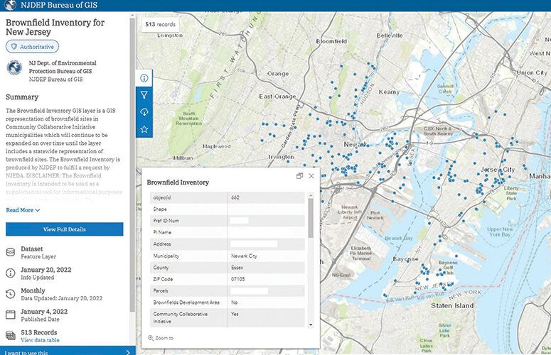
To expand these opportunities, NJDEP is launching a new GIS mapping tool to help investors, developers, community leaders, LSRPs and the public identify brownfields with redevelopment potential.
Based on information accessible through NJDEP records and available through the NJDEP Brownfields Program and the New Jersey Community Asset Map, the Brownfields Inventory GIS layer provides details on potential target sites, including acreage, cleanup status, and property owner contact information.
At present, the tool includes sites located in municipalities participating in NJDEP’s Community Collaborative Initiative: Bayonne, Bridgeton, Camden, Jersey City, Millville, Newark, Paterson, Paulsboro, Perth Amboy, Salem, Trenton and Vineland. NJDEP intends to include opportunities in additional municipalities in future versions of the tool.
NJDEP’s work to share this data and expand its reach represents one more step toward creating new opportunity at the intersection – of environmental, health, social and economic improvement – that we call home.
To access more business news, visit NJB News Now.
Related Articles:

- Accounting
- Banking / Financial
- Coronavirus
- Diversity
- Economic Development
- Economy
- Energy
- Environment
- General Business
- Government
- Healthcare
- High-Tech
- Higher Ed
- Infrastructure
- Labor
- Law
- Life Sciences
- Manufacturing
- Meeting Places
- New Hire/Promotion
- Philanthropy
- Real Estate
- Science & Technology
- Small Business
- Tourism
- Workforce Development
- Special Sections
- Sponsored Content
