NJ Aerial Data Co. Gets FAA Exemption to Fly Drones
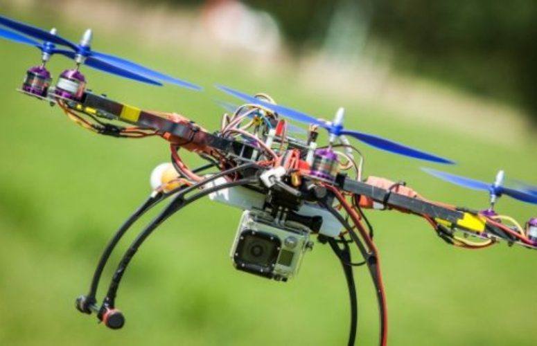
On May 19, 2015A New Jersey-based business has been granted a Federal Aviation Administration (FAA) exemption to operate Unmanned Aerial Vehicles (UAVs) for the purpose of aerial imagery collection. Unmanned Sensing Systems LLC (US2), a Mount Laurel-based developer of UAV technology, will become one of the first companies in the state legally authorized to use drones commercially.
US2 was granted an FAA exemption on April 17 after successfully petitioning the FAA earlier this year, along with a blanket authorization to operate in all 50 U.S. states. The authorization allows the company to legally operate their small, unmanned aircraft for the purposes of collecting aerial imagery, primarily for the benefit of assisting farmers and crop owners in monitoring and optimizing their yields.
Their aircraft, weighing less than 20 lbs. and equipped with specialized imagery hardware, are capable of assessing the health of various forms of vegetation and allow growers to quickly and easily visualize and optimize the expected yield of their crops.
Dan Murray, founder of US2, says it was a long time coming.
“We’ve been working on the technology to do this for years now,” Murray said, “but we’ve not been able to legally provide this service to interested parties in the United States due to the regulatory hurdles. This FAA exemption allows us to finally offer this amazing technology to those who will really benefit from it.”
US2 was incorporated in early 2014 after Murray saw the opportunity to bring the technology to the agricultural industry. A veteran of the tech field, drones combined two of his favorite things, he says. “I’ve always been a tech nerd, but I’ve also always been interested in aviation,” he said, “I remember missing the ball in the outfield as a little leaguer, fixated on the 737s flying overhead. To me, this is the opportunity to combine two of my favorite interests, and when I saw the value this technology provides to farmers and the agricultural industry as whole, it was a no-brainer.”
But recent drone-related press hasn’t been completely positive, with many concerned about how drones may interfere with conventional airplanes. Not to worry, Murray says, “as part of the FAA exemption we were granted and will operate under, we were prescribed certain operating conditions and requirements we must follow – both to keep our operation safe, as well as integrate responsibly into an already busy airspace.” Among other restrictions, US2’s aircraft are only allowed to operate less than 400 ft. above ground level, away from heavily populated areas and within line of sight.
But even at such low altitudes, US2’s UAVs can collect a lot of data. Murray says they can fully scan a 100-acre crop in about 20 minutes, and with such high resolution that it can pick up a bad patch of vegetation only a few inches in diameter. “This is a game changer,” he said. “We can provide near-real time imagery over huge swaths of land, and we can do it without the safety concerns of having a full-scale aircraft so close to the ground.”
The aircraft’s onboard sensors collect a wide variety of data points about the environment below, and then use complex algorithms to combine and analyze it, with the goal of quickly providing actionable information about the health and stress of the vegetation scanned.
US2’s aircraft not only provide aerial imagery, but can also collect and create 3D models of the terrain and features they survey, with detail that approaches that of traditional LIDAR-based laser scanning.
While US2’s efforts are concentrated squarely on the agricultural industry right now, they intend to expand into other industries where they see a fit. Energy and utility infrastructure monitoring and construction survey are both applications US2 says could easily and quickly benefit from this type of technology.
“This is just the beginning. We haven’t even thought of some of the applications for UAVs that will probably be widespread in under a decade. It’s an exciting time, and we’re glad to be a part of it.”
Related Articles:


